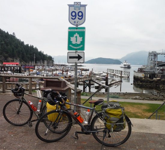
Horseshoe Bay Photo: Rob Weiss
Cyclists around the world have a love/hate relationship with hills. For some, hills represent a mental challenge, others are intrigued by the physical challenge and for many it is simply the thrill of the descent after a long, difficult climb. No matter what draws you to the hills, there is no more desirable, scenic or exciting climb than the Sea to Sky highway. This demanding ride from Vancouver to Whistler is a visual smorgasbord offering panoramic views of Howe Sound and the Coast Mountains. Recently, my husband and I decided to test our legs and set our sites on Whistler.
When asked about our riding style and preferred pace, we often joke that we are ‘dawdlers”. The dictionary defines dawdle as (1) to spend time idly and (2) to move lackadaisically. Rest assured there is nothing lackadaisical about the Sea to Sky highway. The route begins at sea level, stretching from Horseshoe Bay to Whistler covering 102 km in distance with 2400m up, 1750m down and a total end elevation gain of 650m. To say our legs were tired at the conclusion of the ride is an understatement!
The route attracts both road warriors and fellow dawdlers. In fact, numerous cyclists with legs of steel, spinning their way to personal best times passed us during our recent ride. Conversely, we dawdled along and took delight in the views, waterfalls and picnic spots along the way. We also took time to investigate the Sea to Sky Cultural Journey and First Nations history. Interpretive kiosks line the route and are worth the extra stops.
Be warned, the Sea to Sky highway is not for the faint of heart. Historically, cyclists often avoided this route. Today, highway improvements have made the ride more bicycle friendly. However, Sea to Sky is an extremely busy highway and if you are not comfortable riding in traffic it probably is not for you.
Cycling Sea to Sky Photo: Rob Weiss
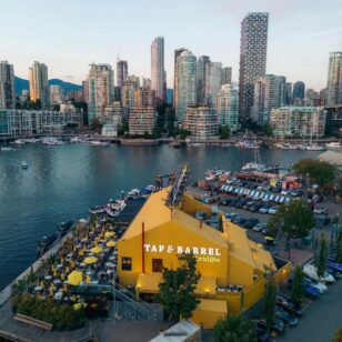
Our day began in Horseshoe Bay. This area, especially in the summer, is a beehive of activity and it’s delightful to watch families with cars, vans, trailers and motor homes packed to the roof excitedly waiting for their ferry sailings. We were feeling quite confident as we departed. We cycled past Porteau Cove, a terrific spot for picnics, paddling and scuba diving! We continued on to Britannia Beach and stopped to savour our morning coffee. We met a fellow from Lions Bay who teased us regarding the climb ahead. “You’ll make it” he said with confidence. Strange how those kind words seemed to fill me with doubt!
We set off again towards Shannon Falls – fantastic! At 335 meters high, the falls are the third largest in British Columbia. They are breathtaking and it is always enjoyable to stop, view the falls and chat with tourists from around the world who flock to the park.
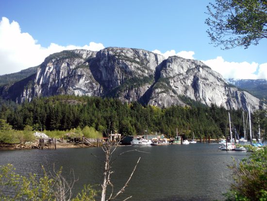
The Chief – view from Squamish Photo: Rob Weiss
We continued past the Stawamus Chief, an extremely popular hiking and climbing spot. The Chief is a magnificent 700-meter-high granite cliff and the view from the top is spectacular. Entering Squamish, we stopped at the Squamish Adventure Centre to request the inside scoop on local bike trails. The staff at the Adventure Centre were fantastic and shared with us the plans for the Sea to Sky Trail. When finished, the trail will be 180km of non-motorized multi-use pathways connecting Squamish to D-Arcy along the Sea to Sky corridor. What a vision!
Brohm Lake and an aptly timed picnic lunch provided another break from the climb. Happily munching we watched paddle boarders and swimmers in the mountain lake. Refueled and refreshed we continued our climb to Whistler Village. We couldn’t resist stopping at Brandywine Falls, another spectacular waterfall where we had the pleasure of meeting a family from Tasmania. They were drawn to our bikes and questioned us about cycle touring in British Columbia.
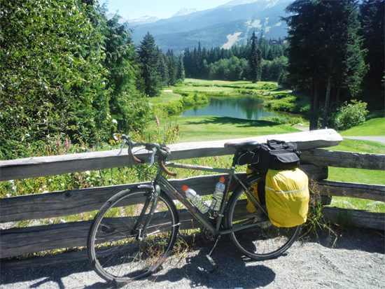
Cycling Trails in Whistler Photo: Rob Weiss
Finishing the ascent to Whistler, we connected to the Valley Trail at Function Junction. It was a welcome relief to leave the highway, join a dedicated bike path and meander our way to the village. Whistler has something for everyone and it is always a thrill to enter the village and be surrounded by active folks – hikers, bikers, rafters, paddlers, skiers, not to mention the shoppers, the sightseers and the “revellers!”
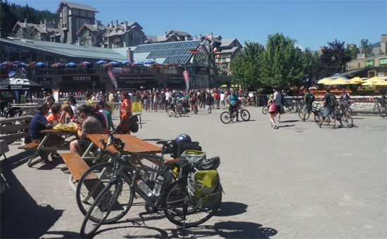
Whistler Village Photo: Rob Weiss
The only thing better than the view on the way TO Whistler, is the view on the way BACK! The entire return trip is on the ocean side of the road and it is almost impossible to not stop frequently to photograph the rivers, the mountains and ocean. On the return trip, breathtaking views of the Tantalus Mountain Range – snow capped mountains, the valley, the forest and the river below are abundant. We would include a picture…but a photo simply doesn’t do the view justice. You must visit and experience it for yourself!
It’s your turn……
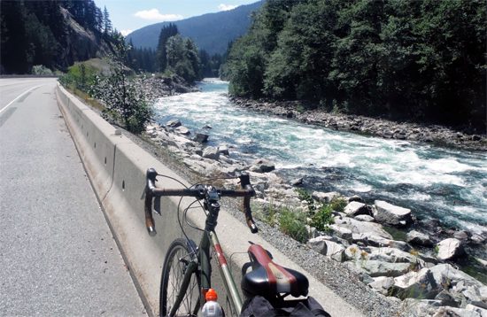
Let the Climb Begin Photo: Rob Weiss
Route Tips:
There is a short stretch between Porteau Cove and Furry Creek where the shoulder becomes quite narrow. Exercise caution!


Pingback: Cycling Vancouver’s Sea to Sky Highway – Gunboat Bay Lodge