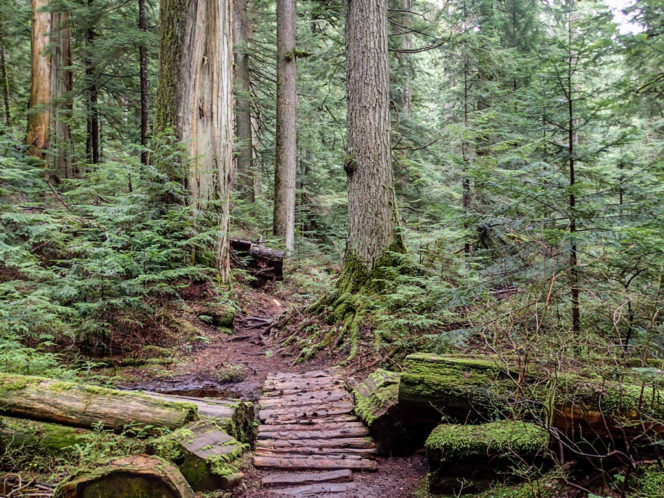
Old Growth cedars along the Brothers Creek Trail
The hike along Brother’s Creek in West Vancouver is a great one for October. It’s not high enough to get snowy or icy and the tree cover overhead keeps you a bit drier on rainy days. This loop route climbs steeply in places, so you need a moderate fitness level. While you won’t summit a mountain or reach an epic viewpoint, there are plenty of beautiful things to see including old-growth cedars, a waterfall, fern-lined canyons, a tiny but picturesque lake, and the ruins of an army truck.
Safety First: Just because this hike is close to Vancouver doesn’t mean you aren’t going to the wilderness. North Shore Rescue recommends bringing a backpack with essential safety and first aid gear on every hike. Check the forecast and pack extra clothing for the weather. And leave a trip plan so someone knows where you are going and when you will be back.
To find the trailhead, head up into the British Properties neighbourhood in West Vancouver. The trail starts at a yellow gate on Millstream Road, just uphill from the intersection with Eyremount Drive. Park your car on the shoulder and don’t block the gate.
Walk through the gate onto the wide gravel Millstream Trail that runs behind some houses. Make your first right onto the Larsen Creek Trail and starting climbing uphill. This trail is an old road dating back to the days when the area was logged. About 1km from the trailhead watch for the ruins of a WWII era army surplus truck on the side of the road.
Continue uphill for a few more minutes to a junction with the Skyline trail under the powerlines. Turn right and follow Skyline for about 100m to another junction. Turn left to head uphill again on the Brothers Creek Trail.
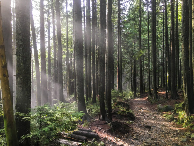
Sunlight filtering through mist along the trail
For the next 1.5km, you’ll be walking along the banks of Brothers Creek. Ignore the junction with the Crossover Trail and stay on the Brothers Creek Trail. At times the trail is next to the creek as it meanders through gravel flats. But mostly, the creek is far below you in a deep canyon, draped with moss and ferns. Keep an eye out for large old growth cedar trees. There are at least a dozen of them along the way.
Brothers Creek drops over a dramatic waterfall that you can glimpse down in the canyon. Just after you pass the waterfall, you’ll arrive at the former site of the Brothers Creek Bridge. The entire bridge was washed away in a winter storm in 2017.
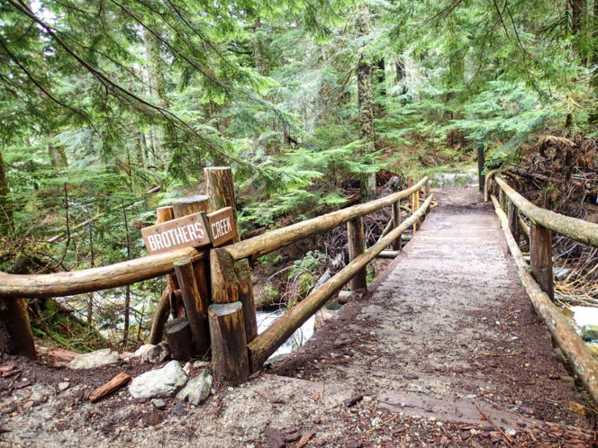
The old Brother’s Creek Bridge. It is scheduled to be replaced in 2020.
Don’t cross the creek. Instead, continue onwards from the bridge site as the slope eases a bit. About 1km later you’ll reach the shores of tiny Blue Gentian Lake, named after an alpine wildflower. It’s more of a pond than a lake. A picnic table makes a great place to take a break. Most days the waters are still enough to create great reflections.
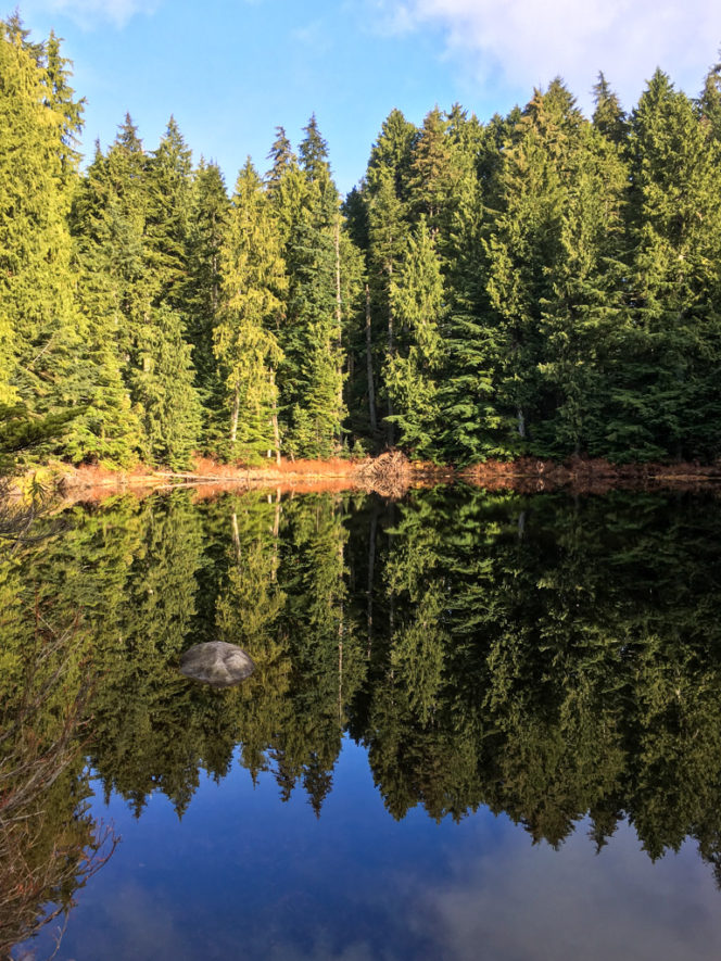
Reflections at Blue Gentian Lake
Just after the picnic table, you’ll arrive at a junction. Turn left to continue along the shores of Blue Gentian Lake on a boardwalk. After the boardwalk, follow the trail for a few hundred meters until it meets up with the Baden Powell Trail. This trail traverses the entire North Shore from Horseshoe Bay to Deep Cove, but today you’ll walk just a few kilometres of it.
Turn left and stay on the Baden Powell Trail as it descends the hillside. Larsen Creek is on your right, often out of sight, but sometimes burbling along near the trail. Ignore the Crossover Trail and stay on Baden Powell until it reaches the Skyline Trail under the power lines. Turn left and follow Skyline for about 100m until you reach the old road of the Larsen Creek Trail. Turn right to head back down the Larsen Creek trail, past the old army truck, to the Millstream Trail and your car.
Trail Stats: 7.3km loop, 760m elevation gain, 4-5 hours.


