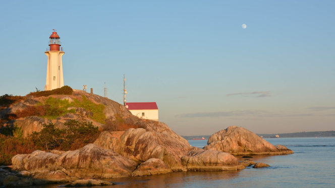
A view of the lighthouse from West Beach. Photo credit: Djordje Cicovic on the Inside Vancouver Flickr pool
Does your New Year’s resolution involve more outdoor time? Kick-off 2020 with a hike. The low elevation trail network at West Vancouver’s Lighthouse Park is usually snow-free all year so it’s a great hiking destination for January. Plus the views of the ocean and downtown Vancouver are incredible.
Trail Stats: 6km loop, 120m elevation gain, 2.5 hours, easy
Safety First: Just because this hike is close to Vancouver doesn’t mean you aren’t going to the wilderness. North Shore Rescue recommends bringing a backpack with essential safety and first aid gear on every hike. Check the forecast and pack extra clothing for the weather. And leave a trip plan so someone knows where you are going and when you will be back.
Getting There: From Vancouver take the Lion’s Gate Bridge to the North Shore, then head west on Marine Drive for about 10km. Watch for the wooden “Lighthouse Park” sign on the left, then turn left into Beacon Lane. Follow this narrow road for a few hundred meters until it ends at a gravel parking lot.
You can also take public transit to Lighthouse Park. Take the 250 bus from downtown Vancouver. Get off at the Beacon Lane stop on Marine Drive in West Vancouver, then walk 350m down Beacon Lane to the park.
The Trail: Lighthouse Park has a very extensive trail network. Many visitors just walk the gravel road to the lighthouse viewpoint, then return to their car. But there are so many other beautiful places to go.
If you want to see the whole park, you can follow a series of trails to make a big loop around the perimeter. Along the way, you’ll visit lots of different viewpoints, beaches, and rocky bluffs. There are lots of different trail junctions and it can get a little bit confusing, but in general, just keep turning right to complete this loop. And don’t forget to bring a copy of the Lighthouse Park map.
To start this hike, find the Juniper Loop trailhead on the northwest side of the parking lot behind a yellow gate. Follow Juniper Loop as it descends and turns into Juniper Point Trail as it heads towards the ocean. About half a kilometre from the parking lot, follow a spur trail out onto the granite bluffs of Juniper Point. Pause to enjoy the great views of Bowen Island across Howe Sound. Watch for the BC Ferries cruising past on their way to Vancouver Island.
The view from Juniper Point. Photo Credit: Colin Knowles on the Inside Vancouver Flickr Pool
From the point, return to the main trail and turn right to continue on Juniper Point Trail as it goes uphill. At a three-way junction, turn right onto Juniper Loop, then turn right again in a few minutes onto Shore Pine Trail. Stay on Shore Pine as it descends through the forest, emerging at another great viewpoint at Shore Pine Point.
After the point, turn right to continue on Shore Pine Trail for another 150m, then turn right to head out to yet another viewpoint. The trail ends a series of gently sloping granite bluffs that are fun to explore.
When you’ve finished clambering around on the bluffs, return to Shore Pine Trail and turn right. About 50m down the trail turn right again onto the West Beach Trail. Follow the trail down to West Beach. This is the best place for photos of the park’s famous lighthouse.
After you return from West Beach, turn right on Shore Pine, then turn right again to head towards the main lighthouse area. The lighthouse itself is closed to the public, but be sure to visit the Lighthouse viewpoint.
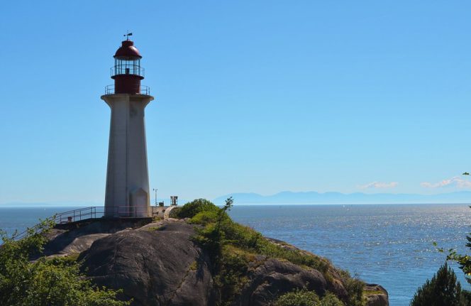
The view of the Point Atkinson Lighthouse from the Lighthouse Viewpoint. Photo credit: Tim Kuelker on the Inside Vancouver Flickr pool
From the viewpoint, follow the trail as it turns into a gravel road near the lighthouse. There’s a washroom building here and a picnic area if you need a break. Find the East Beach Trail on the other side of the clearing near the road. The best views of downtown Vancouver are from East Beach.
Retrace your steps from East Beach back up to the road, turn right and look for the Valley Trail. Follow the Valley Trail through the forest, getting glimpses of the ocean through the trees. At a junction, turn right onto the Star Boat Cove trail. Descend to a tiny gravel beach. The tight rock walls of the cove block out the surrounding area so it’s easy to pretend you’re on a remote beach, not a few minutes from a huge city.
Return from the beach and turn right to stay on the Valley Trail. Go right at the next junction onto the Arbutus Trail and follow it as it heads steeply uphill, then gradually downhill. Make the next right to head out to Eagle Point. This open grassy viewpoint is also a great place to view the city but sees far fewer visitors than the more popular East Beach.
After Eagle Point, return to the main trail and turn right to continue on Arbutus Trail as it climbs steadily through the forest. The trails on the east side of the park are much quieter and you may have them all to yourself.
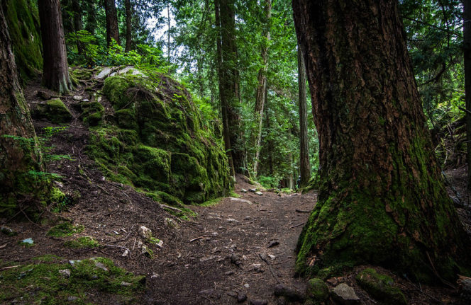
Forest trail in Lighthouse Park. Photo credit: Colin Knowles in the Inside Vancouver Flickr pool
At the next junction, follow signs for the Summit Trail. Climb steeply up the rocky bluffs, staying on the Summit Trail until you reach an open granite dome. This is the highest spot in the park at a whole 120m above sea level!
From the spur trail to the summit, turn left to stay on the Summit Trail, then follow the Salal Trail downhill to the gravel road. Turn right and walk a few metres back to the parking lot. You have now completed your circumnavigation of Lighthouse Park!


