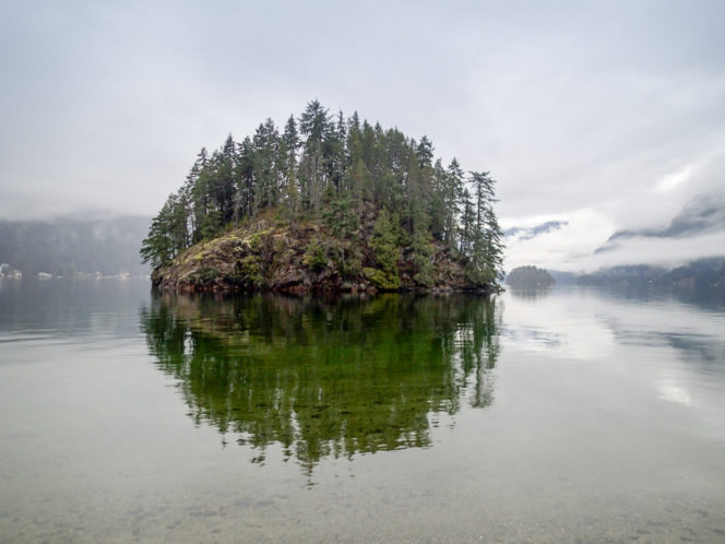
The view of Jug Island from Jug Island Beach. Photo: HappiestOutdoors.ca
This short and easy hike in the Belcarra neighbourhood follows a peninsula before emerging at a remote beach. The trail stays in the beautiful and mossy temperate rainforest the entire way, making it a great destination for a rainy or cloudy February day. A viewpoint in the middle and the beach at the end give you a close-up look at the coastline, a rarity on Vancouver’s mountain-dominated hikes.
Trail Stats: 5.5km return, 100m elevation gain, 2-2.5 hours, easy
Safety First: Just because this hike is close to Vancouver doesn’t mean you aren’t going to the wilderness. North Shore Rescue recommends bringing a backpack with essential safety and first aid gear on every hike. Check the forecast and pack extra clothing for the weather. And leave a trip plan so someone knows where you are going and when you will be back.
Getting There: The Jug Island Beach Trail is located in Belcarra Regional Park east of Vancouver in the village of Belcarra near Port Moody. To get there from Vancouver, head east on Hastings Street. Hastings eventually becomes Barnet Highway (Highway 7A). As you reach Port Moody, turn left at the traffic light onto St. John’s Street to stay on Highway 7A for a few kilometres.
Turn left onto Ioco Road and drive a few blocks through Port Moody. Then turn left again at a major intersection to stay on Ioco Road. Follow Ioco for 4km, then turn right onto First Avenue, which becomes Bedwell Bay Road. Continue on Bedwell Bay for 2.4km to a Y-junction where you go left onto Tum-Tumay-Whueton Road into the park. Stay on this road until it ends at a parking lot in about 4km.
The park is open from 7 am until 5 pm in the winter. The road into the park is gated where Tum-Tumay-Whueton Road leaves Bedwell Bay Road. Make sure you give yourself enough time to hike so you don’t get locked in.
You can also get to the trailhead on public transit. Take the Skytrain to the Moody Centre Station on the Evergreen Line. From there, take bus 181 or 182 to the Bedwell Bay Road at Midden Road stop. The trailhead is on the north side of the road near the bus stop.
The Trail: The route to Jug Island Beach is easy to follow, but be sure to bring a copy of the Belcarra Regional Park map to make sure you stay on track.
To find the trailhead, head towards the covered picnic area near the parking lot. Look for a trail heading through the trees to the north. Follow it for a minute until it emerges at a paved road.
Cross the road. From here there are a few different trails. Follow the signs for the Jug Island Beach Trail heading left. The trail heads into the forest and begins climbing steeply. Soon, the footbed gets a bit wider and the trail gets flatter. There are a few staircases in this portion.
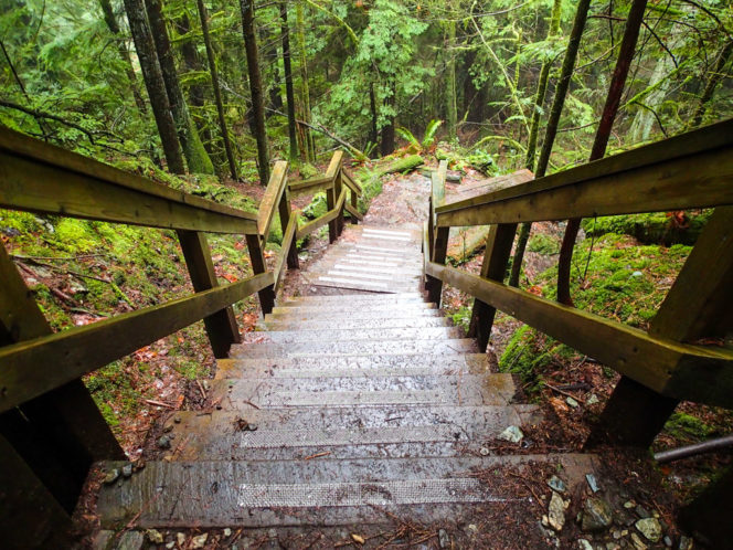
One of the staircases on the trail. Photo: HappiestOutdoors.ca
About 1.5km from the trailhead, you’ll reach a junction. Go right to stay on the main trail to Jug Island Beach. The trail starts climbing again with the help of a few stairs to the highest point of the hike. Be sure to look to your right as there are great views of Bedwell Bay down below you.
After the high point, the trail continues downhill slowly through the trees. The final section of the trail is a steep descent down to Jug Island Beach. There’s an outhouse just above the beach if you need to go. The island itself is just offshore.
From the beach, you can look across to Quarry Rock in North Vancouver’s Deep Cove neighbourhood and north up the fjord of Indian Arm. Spend a few minutes exploring the pebbled coastline and having a snack before retracing your steps back to the parking lot.
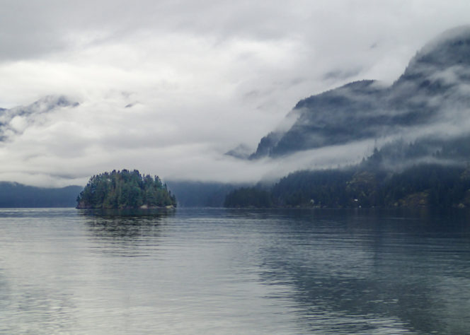
The view of Indian Arm from Jug Island Beach. Photo: HappiestOutdoors.ca


