Photo: Vlad D/Unsplash
Finish out the summer hiking season with a trip to one of Vancouver’s most spectacular viewpoints. The trail to St. Mark’s Summit climbs through the forest of Cypress Provincial Park to an incredible clifftop vantage point with great views of Howe Sound.
Safety First: AdventureSmart recommends bringing a backpack with essential safety and first aid gear on every hike. Check the forecast and pack extra clothing for the weather. Leave a trip plan so someone knows where you are going and when you will be back.
Trail Info: Moderately difficult, 12km round trip, 450m elevation gain, 5 hours, dogs allowed on leash
Getting There: Take the Cypress Bowl Road exit from the Trans Canada Highway in West Vancouver. Follow the road up the mountain to its end at the Cypress Mountain Ski Lodge.
The Trail: The route to St. Mark’s Summit involves a few trail junctions, but if you pay attention to the signposts and bring the park map, it’s easy to stay on track. The hike follows the first section of the Howe Sound Crest Trail. Be sure to pay attention to trail markers in the second half of the hike as there have been a few search and rescue tasks in this area when hikers missed markers and left the trail.
Start your hike by following the path past the ski lodge and the chairlift onto the southern branch of the Yew Lake Trail. This flat trail is wheelchair-friendly and travels through an ecologically fragile area of sub-alpine ponds and wetlands.
Follow the trail alongside Cypress Creek and the shores of marshy Yew Lake, ignoring the Black Mountain Trail heading uphill to the left. At the next intersection, the Yew Lake Loop continues to the right, but your route to St. Mark’s Summit goes left. The path heads into a thick old-growth forest, then slightly uphill to a gravel road. Turn left on the road and hike for a few minutes to the intersection with the Howe Sound Crest Trail.
From here, you’ll climb steeply uphill on a series of long switchbacks. Once the trail starts to level out, watch for a junction. Take the short side trail downhill to the left to enjoy the views from Bowen Lookout, then retrace your steps to the intersection and continue along the Howe Sound Crest Trail.
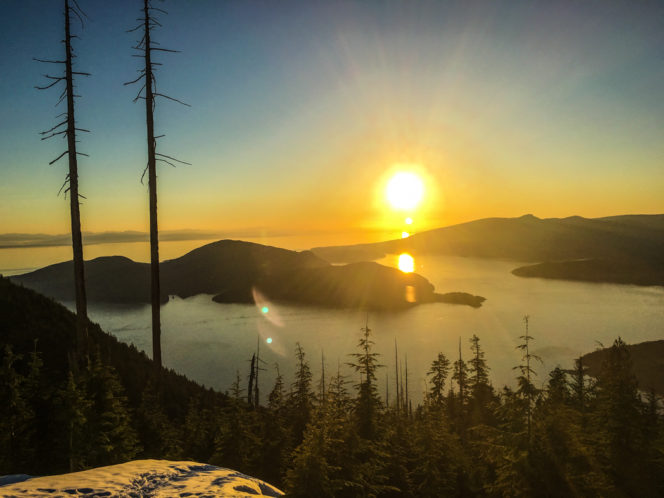
The view from Bowen Lookout at sunset. Photo: Taryn Eyton/ HappiestOutdoors.ca
In a few minutes, arrive at another junction with a large map board. Go left and follow the trail as it contours along the side of the mountain. About 10 minutes later, the trail emerges into an open area and crosses two small bridges. Keep following the trail as it begins to zigzag uphill. The first few switchbacks are on a newly rebuilt trail, but the improvements soon end. The remainder of the hike is rough with lots of tree roots underfoot. Keep an eye out for trail markers to ensure you stay on the trail.
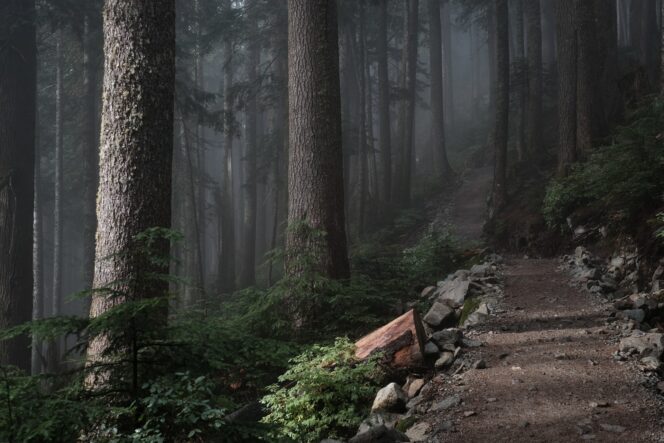
Photo: Derrick Cooper/Unsplash
After the switchbacks, the trail travels along the top of a ridge, but you can’t see much through the trees. A brief flat stretch lets you catch your breath before the final climb to the summit. After you ascend a few more switchbacks and pass by muddy ponds, you’ll arrive at the rocky peak.
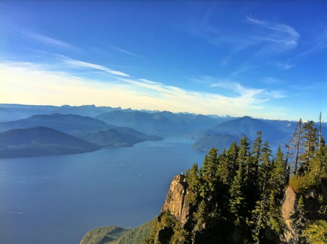
Photo: Kyle Pearce/Flickr used under CC BY-SA 2.0
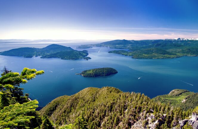
Follow a side trail downhill to the left for even better views. Look down to Howe Sound, Bowen Island, and Gambier Island, and across to the forested peaks of the Sunshine Coast. Use care and stay well back from the edge as the cliffs are sheer and there have been accidents here. When you are finished enjoying the views, retrace your steps to the parking lot.
If you’d prefer a more organized adventure, check out www.bcadventurecompany.ca who offers guided tours to St. Mark’s Summit.


