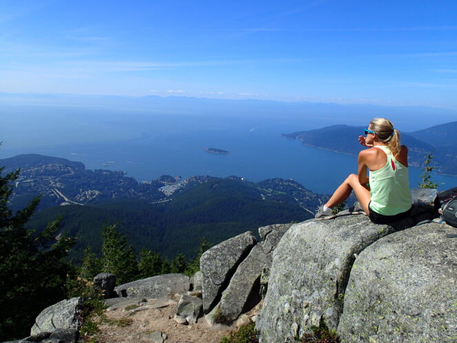
A hiker enjoys the view at Eagle Bluffs in Cypress Provincial Park. Photo: Taryn Eyton
With a spectacular vantage point atop a granite outcrop, Eagle Bluffs in Cypress Provincial Park is a great late summer hike to soak up ocean and city views.
Trail Info: Moderate; 9 km round trip; 270 m elevation gain; 4 hours; dogs allowed on leash
Safety First: AdventureSmart recommends bringing a backpack with essential safety and first aid gear on every hike. Check the forecast and pack extra clothing for the weather. Leave a trip plan so someone knows where you are going and when you will be back. Check out our tips for safe summer hiking in Vancouver for more advice.
Getting There: From Vancouver, take the Lions Gate or Iron Workers Memorial Bridges to North Vancouver, then take Highway 1 west. Take exit 8 for Cypress Bowl Road and follow it up the mountain to the road’s end at the Cypress Mountain downhill ski area.
The Trail: There are lots of hiking trails in Cypress Provincial Park. Bring a copy of the park map and pay close attention to signs as you hike.
To find the trailhead, walk past the Cypress Creek Lodge and the Olympic rings. Follow a gravel road west to the bottom of the Eagle Express Chairlift. The Baden Powell Trail begins here, heading into the forest just past the chairlift. Follow the trail beside a creek for a few minutes to a junction. Go left to stay on the Baden Powell Trail, following signs for Black Mountain.
The trail begins to climb steeply here on a series of gravel switchbacks that can be loose. As you gain elevation, several side trails to the left lead to the ski runs. Ignore these and stay on the main trail. You’ll know you have almost finished the ascent when the trail ascends a set of stone stairs.
Arrive at a T-junction about 2 km from the parking lot. There are two choices from here, both of which meet up later. It can be fun to take one route on the way there and the other on the way back. If you go right you’ll pass by Cabin Lake, a popular swimming spot, then climb up and over the rounded summit of Black Mountain before rejoining the other trail about 0.5 km later. The route to the left is twice as long (1 km to the junction) and meanders past several other small lakes but has less climbing.
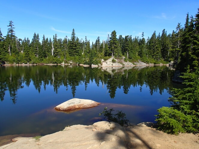
Cabin Lake, a popular swimming spot. Photo: Taryn Eyton
After the two routes converge, follow the Baden Powell Trail as it curves west and starts to descend. You will lose about 100 m of elevation between here and the viewpoint at the trail’s end, so be sure to save some energy for the climb on the way back. You may be able to spot a few small ponds through the trees as you hike. About 4 km from the start, ignore a faint trail branching away to the right and stay on the main Baden Powell Trail as it continues to descend gently for a few more minutes. Arrive at a beautiful viewpoint atop Eagle Bluff about 4.5 km from the start.
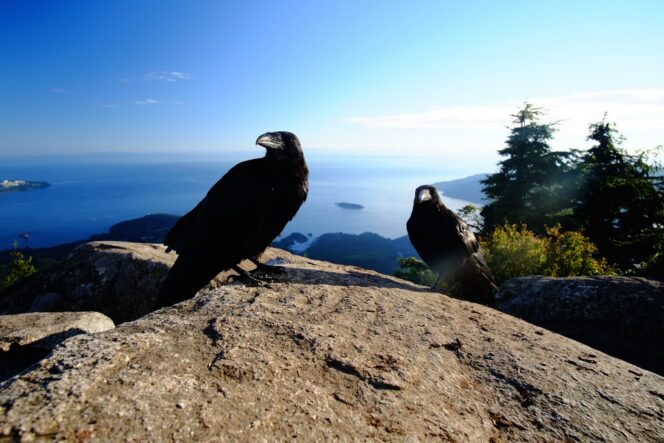
Ravens at Eagle Bluffs. Photo: Vlad D/Unsplash
Take a few minutes to wander around the granite outcrop to enjoy the views of Howe Sound, Burrard Inlet, and Point Grey. On clear days you can also see Vancouver Island in the distance. The Baden Powell Trail continues steeply downhill to Horseshoe Bay from here, but most hikers will want to retrace their steps to their car at the Cypress Mountain ski area, perhaps completing the other side of the Black Mountain loop on the way.


