Photo: Kelen Loewen/Unsplash
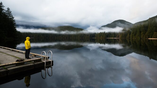
The easy hike in təmtəmíxʷtən/Belcarra Regional Park is a great option for December since it avoids snow. In the summer, Sasamat Lake is a busy beach destination, but in winter, you might get it all to yourself.
Trail Info: Easy; 9 km round-trip; 100 m elevation gain; 3 hours; dogs allowed on leash
Safety First: AdventureSmart recommends bringing a backpack with essential safety and first aid gear on every hike. Check the forecast and pack extra clothing for the weather. Leave a trip plan so someone knows where you are going and when you will be back. Check out our tips for safe winter hiking in Vancouver for more advice.
Getting There By Car: From Vancouver, head east on Hastings Street which becomes Barnet Highway (Highway 7A). Once you reach Port Moody, turn left onto St. John’s Street to stay on Highway 7A.
Turn left onto Ioco Road and drive a few blocks, then turn left again to stay on Ioco Road. Follow Ioco for 4km, then turn right onto First Avenue, which becomes Bedwell Bay Road. Continue on Bedwell Bay for 1.2 km, then turn right onto White Pine Beach Road into təmtəmíxʷtən/Belcarra Regional Park. Follow the road to its end at a parking lot. In winter, the park is open between 7 a.m. and 5 p.m.
Getting There By Public Transit: Take the Skytrain to the Moody Centre Station on the Evergreen Line. From there, take bus 182 to the Bedwell Bay Road at White Pine Beach Road stop. Walk 100 m along White Pine Beach Road, then go left down the stairs onto the connector trail. Follow the trail for a few minutes to join the Sasamat Lake Loop Trail at the floating bridge. Turn right to head towards the day-use area and the start of the hike.
The Trail: This route ties together two shorter loop trails, Sasamat Lake Loop and Woodhaven Swamp Loop. If you are short on time or energy, skip the Woodhaven portion to make a 3 km loop that will take about an hour.
The hike lies in təmtəmíxʷtən/Belcarra Regional Park, which means that are good signs at all junctions so its easy to stay on track. But bring a copy of the park map, just in case.
From the parking lot, head down to the beach and day-use area, then go right along the shoreline to find the Sasamat Lake Loop Trail just past the washroom building. Follow the trail through the forest for a few minutes, then climb a set of stairs. Turn left at the top onto the Bowzer Trail, an old dirt road.
A few minutes later, the trail crosses a road just outside the gates to the Sasamat Outdoor Centre. Pick up the path on the other side, heading down a set of stairs. Cross a creek, then arrive at a junction. Turn right to head to Woodhaven Swamp. (Going left will take you on the shorter route that skips the swamp.)
Follow the Woodhaven Connector trail uphill to a marked crosswalk on Bedwell Bay Road. Cross the road, then continue along the trail as it passes between large houses. Stay on the trail as it climbs a steep hill. The trail heads downhill and passes under some powerlines. Use the marked crosswalk to cross Tum-Tumay-Whueton Drive.
Once across the road, arrive at a junction with the Woodhaven Swamp Loop. Follow the 1.2 km long trail as it circumnavigates the swamp on a mix of boardwalk and trail. There are several great viewing platforms where you can watch for birds and other wildlife.
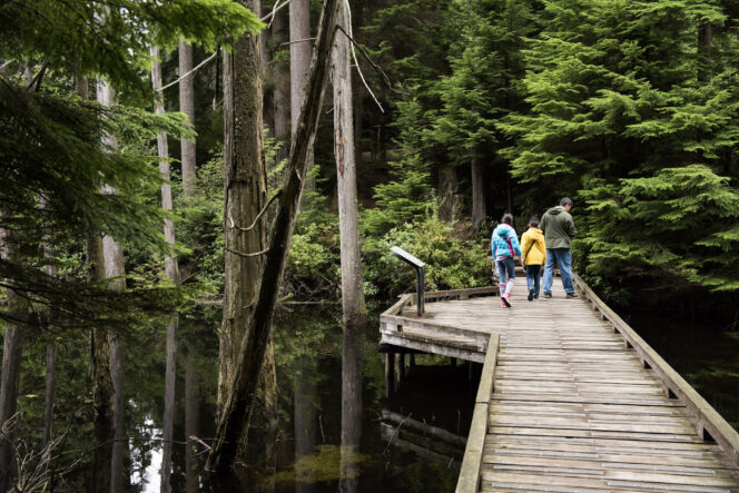
Photo: Metro Vancouver
Back at the junction, turn right and retrace your steps on the Woodhaven Connector Trail, recrossing Tum-Tumay-Whueton Drive and Bedwell Bay Road. Turn right at the junction to rejoin the Sasamat Lake Loop. The trail heads behind the Sasamat Outdoor Centre, then follows the lakeshore. There are lots of places to stop and admire the views across the lake.
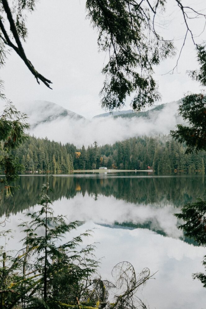
Photo: Priscilla Du Preez/Unsplash
About 1 km after the junction, the trail crosses the lake on a unique floating bridge. Two platforms at the midway point make great places to take a break and soak up the scenery.
On the other side, turn left and follow the trail along the lake for another kilometre back to the day-use area and parking lot. Turning right will take you to the bus stop on Bedwell Bay Road.


