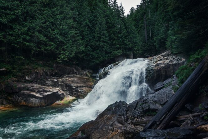
Lower Falls in Golden Ears Provincial Park. Photo: Donna McL/Unsplash
The easy hike to Lower Falls in Golden Ears Provincial Park is a perfect hike for April. As temperatures warm up, snow melt in the mountains sends raging torrents of water over the falls, a spectacular sight.
Trail Info: Easy; 5.2 km round trip; 120 m elevation gain; 1.5-2 hours; Dogs allowed on-leash. Note: A free BC Parks day pass is required between late May and early October.
Safety First: AdventureSmart recommends bringing a backpack with essential safety and first aid gear on every hike. Check the forecast and pack extra clothing for the weather. Leave a trip plan so someone knows where you are going and when you will be back. Check out our tips for safe spring hiking in Vancouver for more advice.
Getting There: From Vancouver, take Highway 1 east. Use exit 44 to transfer onto the Mary Hill Bypass (Highway 7B). Follow signs to get onto Lougheed Highway (Highway 7) and go over the Pitt River Bridge. About 6 km later, turn left onto Golden Ears Way and stay on it as it becomes 128 Ave. Turn left onto 224 Street, then turn right a few blocks later onto 132 Avenue. At the roundabout, turn left to stay on 132 Avenue, which becomes Fern Crescent, then changes its name to Golden Ears Parkway as you enter Golden Ears Provincial Park. Drive through the park, past the turn-offs for the beach and campgrounds. Cross the one-lane bridge over Gold Creek, then turn left into the East Canyon parking lot. There are pit toilets in the parking lot.
The Trail: The trail to Lower Falls (also called Gold Creek Falls) is mostly flat and easy to follow. Use the park map to find your way. It starts on the west side of the parking lot. (The trail on the east side of the parking lot does not lead directly to the falls.)
From the parking lot, follow the Lower Falls Trail as it slowly gains elevation. The wide gravel trail travels through a mossy forest. You can hear the creek to your left and sometimes glimpse it through the trees.

Photo: Priscilla du Preez on Unsplash.
After about 1.5 kilometres, look for a side trail to your left. It leads to the sand and gravel banks of the creek. There are good views of Edge Peak, Alouette Mountain, Evans Peak and Blanshard Needle. This is a great spot for a snack.
Back on the main trail, continue following the path gently uphill. Around 2.5 km from the parking lot cross two small bridges and arrive at an outhouse. From here, climb up a small rise to the viewing platform at the waterfall.
Gold Creek plummets 10 meters (33 feet) over the rocks. If you visit during the spring melt, the falls are spectacular with torrents of water plunging over the falls. Stay well back from the edge as it is very slippery and there have been several fatal accidents here.
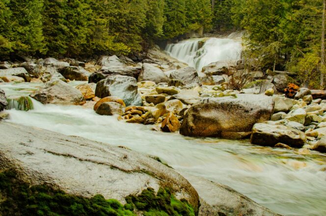
Lower Falls in Golden Ears Provincial Park. Photo: Larry Nalzaro/Unsplash
When you are finished admiring the falls, retrace your steps to your car. However, if you’re up for a bit more adventure, you can follow the trail from the viewing platform uphill to Upper Falls. This trail is a little rougher and there is no formal viewing area. Again, be careful and stay away from the cliff edge.
From Upper Falls, you can head back to Lower Falls or take the very steep and rough Connector Trail uphill to intersect the East Canyon Trail and make a loop hike. If you take the Connector Trail, turn right at the junction to follow the East Canyon Trail back to the parking lot. This trail is an old road left over from long ago-logging. Taking this option will add about 0.5 km and about 100 m of elevation gain to your trip.
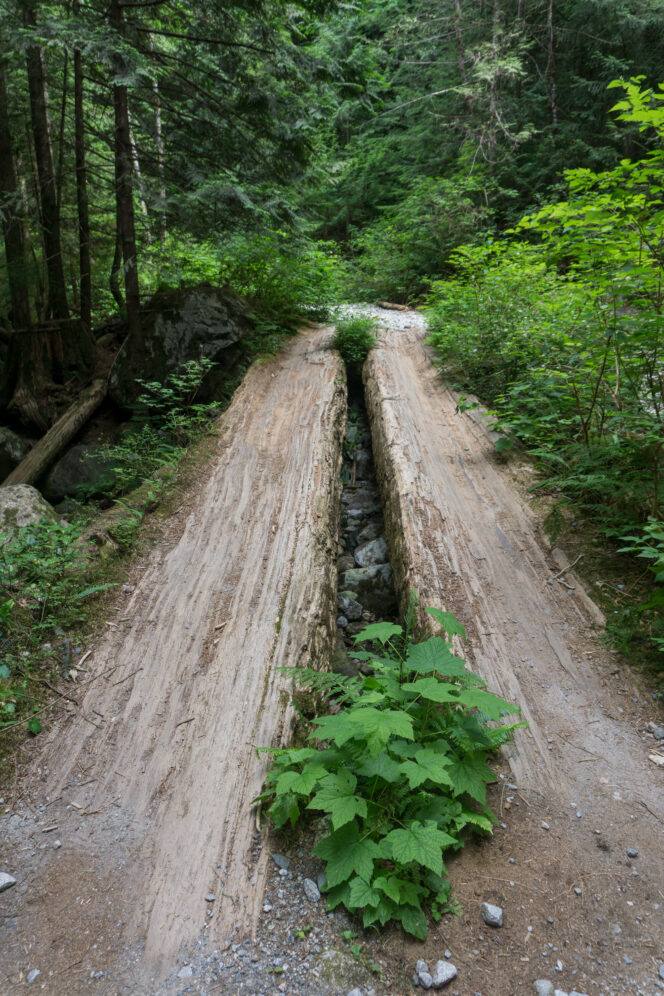
Old logging road bridge on the East Canyon Trail. Photo: Taryn Eyton/HappiestOutdoors.ca