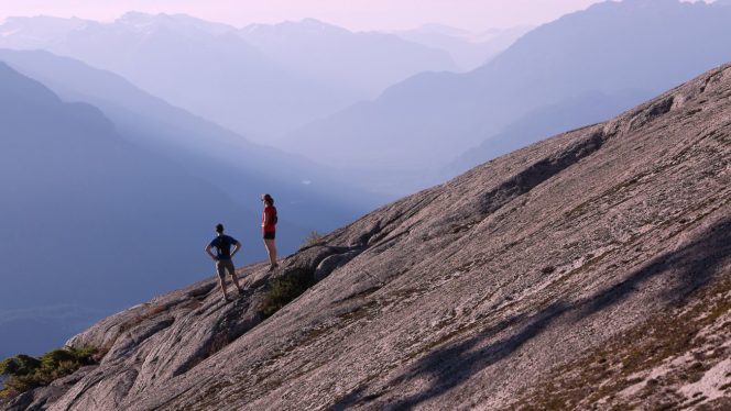
Hikers on the Al’s Habrich Ridge Trail. Photo: Sea to Sky Gondola
Thanks to the Sea to Sky Gondola, you can get high into the mountains above Howe Sound to go for a spectacular hike. Follow the Al’s Habrich Ridge Trail up to the top of a granite ridge for panoramic views.
Trail Info: Moderate; 7 km round-trip; 340 m elevation gain; 4-5 hours; Dogs not permitted.
Safety First: AdventureSmart recommends bringing a backpack with essential safety and first aid gear on every hike. Check the forecast and pack extra clothing for the weather. Leave a trip plan so someone knows where you are going and when you will be back. Check out our tips for safe summer hiking in Vancouver for more advice.
Getting There: From Vancouver, head west on Highway 1. In West Vancouver, follow signs to go north on Highway 99. Just before you reach the town of Squamish, turn right into the signed parking lot for the Sea to Sky Gondola. You can also get there on the Squamish Connector Bus which leaves from downtown Vancouver. From the parking area, ride the Sea to Sky Gondola up to the Summit Lodge.
The Trail: The trails at the Sea to Sky Gondola are easy to follow with frequent diamond-shaped markers that are numbered so you tell you are on track. It’s also a good idea to download the Sea to Sky Gondola app which has trail maps with GPS locating so you can tell where you are.
To start the hike, exit the gondola and take the stairs down to the plaza. Follow the wide gravel road at the back of the plaza down a slight hill. At the bottom, ignore the service road descending to the left and the Wonderland Loop Trail heading right. Instead, continue straight and slightly uphill on the wide gravel road.
About 100 m later, turn left following the signs for Al’s Habrich Ridge Trail. The path changes from easy gravel to rugged trail immediately as the route undulates across rocks and dirt at the base of a granite outcropping.
A few minutes later, reach a creek crossing. Early in the season or after heavy rain, this area can be slippery and you may struggle to keep your boots dry. But for most of the summer, it is easy to hop from rock to rock to get across. A rope strung between the trees helps you keep your balance.
The next section of the trail climbs through the trees and then along the spine of a granite ridge. The trail can be a bit indistinct here. Pay close attention to the markers to stay on track and avoid taking unofficial side trails. In a few places, there are ropes to help you scramble up steep sections of rocks.
About 1.5 km from the start the views really open up as the route reaches an open area on the top of the ridge. You can look down to your left towards the Stawamus Chief and up to your right to the granite bluffs above you. In a few places, spur trails to the left lead to even better views.
Continue following the markers along the ridge. As the open bluffs of the ridge end, watch carefully to follow the trail to the right into a wooded gully. Stay on the trail through here as the rugged path works its way steeply upwards through the trees.
Ignore some unmarked side trails and stay on the main route. As the path begins to level out, emerge from the forest onto the top of a huge granite bluff. The views from here are spectacular – you can see all the way down to Howe Sound. Some hikers may wish to make this their turn-around point since it has the best view.
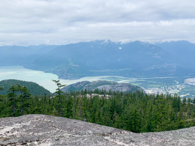
View from Al’s Habrich Ridge Trail. Photo: Taryn Eyton/HappiestOutdoors.ca
But if you have more energy, you can continue to the end of the trail at Neverland Lake. Continue following markers across the bluff and into the forest. The vegetation changes here to become much more typical of a subalpine ecosystem. The thick forest gives way to a more open forest punctuated with pretty little ponds and patches of meadow.
Continue along the trail as it rambles up and down, crossing a small creek. Stay on the Al’s Habrich Ridge Trail at two junctions (going left leads to Neverland Falls Loop which will add another hour to your hike.) The trail ends at tiny Neverland Lake, which is really more of a pond. The highlight here is not the lake but instead the view. Cross the stream at the end of the lake and follow the trail up to a little bluff to the viewpoint.
When you have finished admiring the scenery, retrace your steps back to the gondola. Allow enough time to snap some photos at the Sky Pilot Suspension Bridge and enjoy a cold drink on the incredible patio.
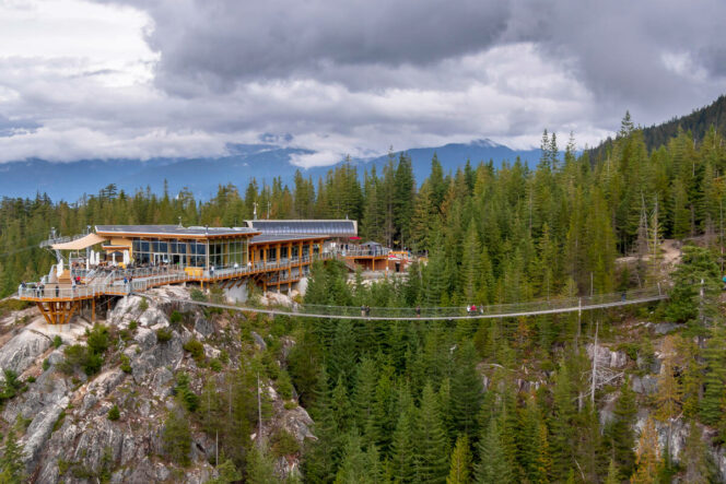
Aerial view of the Sea to Sky Gondola and the Sky Pilot Suspension Bridge. Photo: Destination BC/Heath Moffatt