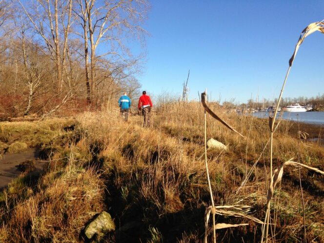
Exploring the shoreline near the south end of Deas Island. Photo: Taryn Eyton
Did you know you can hike right over the George Massey Tunnel? The short and easy trail around Delta’s Deas Island Regional Park at the tunnel’s south end is a great hike for February. It’s right at sea-level, so it avoids the snow and is a great walk, even in wet weather. With fewer leaves on the trees, it’s also a wonderful place spot many types of birds, including eagles.
Until further notice, in line with the public health order, non-essential travel into, within, and out of BC is not recommended. BC residents, let’s do our part by continuing to stay small and support local with your immediate household, in accordance with the latest guidelines.
Safety First: AdventureSmart recommends bringing a backpack with essential safety and first aid gear on every hike. Check the forecast and pack extra clothing for the weather. Leave a trip plan so someone knows where you are going and when you will be back. Hiking is a little different during the pandemic. Read our tips for getting outdoors during COVID-19.
Trail Stats: Easy, 6km loop, no elevation gain, 1.5-2 hours, dogs allowed on leash
Getting There by Car: From Vancouver, take Highway 99 south to Richmond, then go through the Massey Tunnel. Take exit 28 (the first exit after the tunnel), then take River Road (Highway 17A) north for 2.5km. Turn left onto Deas Island Road and follow it into the park.
Getting There by Bus: Take bus 640 from Scott Road Skytrain Station. Get off at the River Road/Deas Island Road stop and walk a few minutes down Deas Island Road into the park.
History: Deas Island is named for John Sullivan Deas, one of BC’s early Black pioneers. Deas started one of the first salmon canneries on the Fraser River on the island that now bears his name.
The Trail: This flat loop around Deas Island visits several different viewpoints over the Fraser River. Some of the trails are quite sandy, but it’s very easy walking. Most of the junctions are well signed but bring the park map to stay on track.
Beginning from the closest parking lot to the park gate, follow the path from the end of the parking lot past the front of the Delta Deas Rowing Club. Walk out onto the floating dock to enjoy views of the calm waters on the east side of the island, known as Deas Slough.
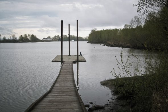
Floating dock on Deas Slough. Photo: Tourism Delta/Facebook
Continuing past the rowing club and some picnic tables, follow the path into a stand of trees. Turn left on the Tidal Pond Trail and follow it as it skirts the edge of the marshy pond, just visible through the trees.
A few minutes later, go left on the Slough View Trail, a sandy path that breaks out into an open area of ecological restoration, and then heads towards Deas Slough. Follow the path along the slough on the top of a dyke. There are peek-a-boo views of the water through the bushes and plentiful birdlife.
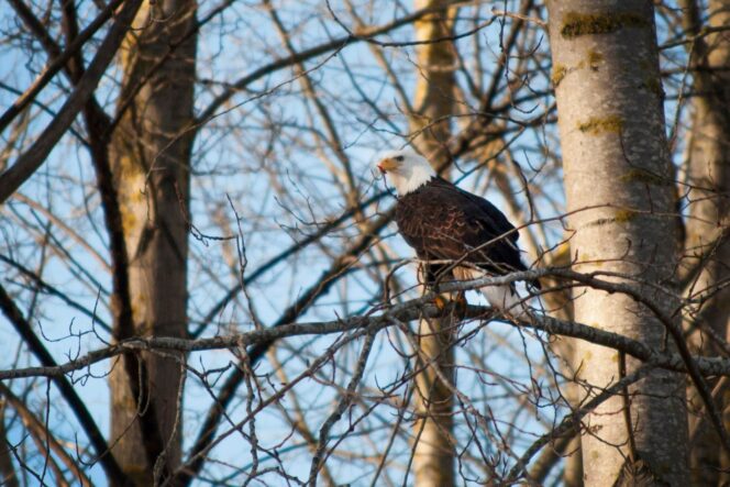
A eagle perched in a tree on Deas Island. Photo: Metro Vancouver Parks/Facebook
After about 10 minutes, ignore a trail branching to the right – it goes back to the main park road. Shortly after that, follow a spur trail to the left to a great viewpoint over Deas Slough. Retrace your steps back to the main path and continue along the trail for a few more minutes.
Go left onto the Sand Dune Trail through a sandy area with lots of horsetails and rushes. A few minutes later, turn left again onto the Island Tip Trail. This broad gravel trail takes you to the Fraser River side of the island. Behind the fence on your left is the entrance to the George Massey Tunnel which whisks thousands of cars under the Fraser River each day.
Continuing along the Island Tip Trail as it heads back into the trees, go right at the fork and walk out to the southernmost tip of the island. The trail emerges at a small beach and a few viewpoints then loops around to meet back up with the fork.
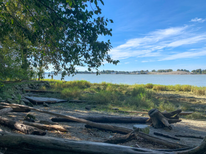
The small beach near the southern tip of Deas Island. Photo: Taryn Eyton
Follow the Island Tip Trail back past the tunnel, then left onto the Riverside Walk and Tinmakers Walk Trails. These two trails take you along the Fraser River side of Deas Island on a broad gravel path. There are several viewpoints where you can look out across the river.
As you make your way back to the heart of the park, the pathway runs closer to the road. You will see Burrvilla, a 100-year old Victorian house, and the Inverholme Schoolhouse across the road. Both of these historic structures were moved to Deas Island Park in the 1980s to preserve them. They are open by appointment only.
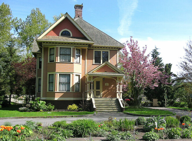
Burrvilla. Photo: Tony Fox/Wikimedia Commons
Don’t miss a spur trail to the left that leads out to an elevated viewing platform. It’s a great place to spot birds like eagles and herons. There’s also an incredible view of Vancouver and the North Shore Mountains. From the platform, continue along the path as it parallels the road, passing numerous picnic tables and benches. Before long, you’ll arrive back at your car in the parking lot.


