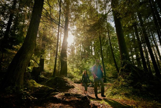
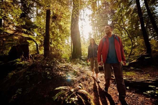
Forest trail in Stanley Park. Photo: Destination Vancouver/Kindred & Scout
When someone says Stanley Park, you probably think of the aquarium, seawall, and beaches. But many visitors miss the beautiful forested interior, perfect for hiking. This easy loop hike hits several gorgeous viewpoints between sections of picturesque rainforest.
Trail Info: Easy; 8 km loop, 75 m elevation gain, 2.5-3 hours, dogs, allowed on leash.
Safety First: AdventureSmart recommends bringing a backpack with essential safety and first aid gear on every hike. Check the forecast and pack extra clothing for the weather. Leave a trip plan so someone knows where you are going and when you will be back. Check out our tips for safe winter hiking in Vancouver for more advice.
Getting There: The easiest way to get to Stanley Park is via public transit. Bus 19 goes directly into Stanley Park. You can catch it from Metrotown Skytrain Station, stops along Kingsway, or stops along Pender and Georgia Street in downtown Vancouver. Get off the bus at the last stop at the Stanley Park bus loop.
If you want to drive, go north on Georgia Street in downtown Vancouver, then follow signs to exit to the right into Stanley Park. Go left at the roundabout onto Pipeline Road. Turn right into the signed parking area for the Stanley Park Railway, which is just north of the bus loop.
The Trail: The trails in Stanley Park are well-signed, but the network is large so it can get confusing. Bring a copy of the trail map to stay on track.
From the bus loop, head south past the Stanely Park Pavillion into the Rose Garden. Turn right and follow the path to a crosswalk on Pipeline Road. Cross the road and follow the sidewalk south to the roundabout. Continue through the underpass under Georgia Street, cross the road, and arrive on the shore of Lost Lagoon.
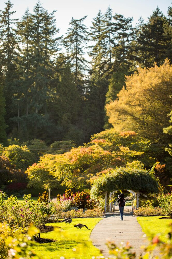
Stanley Park Rose Garden. Photo: Destination Vancouver/Nelson Mouellic
Turn right and follow the trail along the lagoon. Watch for ducks and geese swimming in the reeds. A few minutes later, turn right onto a wide gravel path to reach North Lagoon Drive. Cross the road and join the Tatlow Walk Trail on the other side. Continue along Tatlow Walk for over a kilometre, ignoring other trails branching right and left. Look for giant old-growth trees in the section between Bridle Path and Lover’s Walk.
Forest trail. Photo: Destination Vancouver / Hubert Kang
Cross Stanley Park Drive at the crosswalk and continue on Tatlow Walk on the other side. The trail takes you out of the forest into an open grassy area near the Third Beach Concession. Take a brief detour down to the beach to admire the view of English Bay.
Third Beach in Stanley Park. Photo: Destination Vancouver / Hubert Kang
When you are ready to continue your hike, find the start of Merilee’s Trail, which is the second trail to the right of the spot where you came out of the forest. Follow Merilee’s Trail through the forest for a few minutes, then turn left onto the Siwash Rock Trail. Stay on the trail as it descends slightly. Turn left onto the spur trail to the Siwash Rock Lookout.
The lookout is actually the top of an old searchlight station, left over from World War II. This light, along with other stations at Tower Beach near UBC, was part of Vancouver’s wartime defences. From the viewpoint, look down to the seawall and Siwash Rock just offshore.
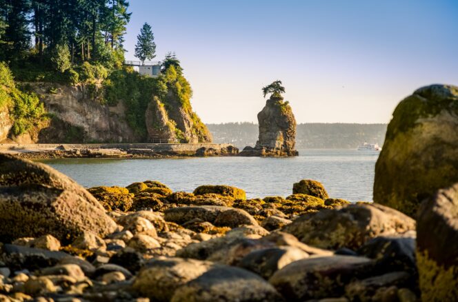
Siwash Rock with the Siwash Rock lookout to the left. Photo: Mike Benna/Unsplash
Retrace your steps back to the main Siwash Rock Trail and turn left. Hike along the trail as it meanders through the woods at the top of the cliffs. Reach an intersection with Merilee’s Trail and turn left, then reach Stanley Park Drive almost immediately after. Turn left and follow the sidewalk past the parking area to the Prospect Point Viewpoint. Admire the view of the Lion’s Gate Bridge, West Vancouver, and the entrance to Burrard Inlet.
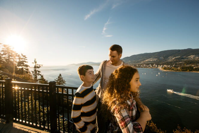
Propsect Point. Photo: Destination Vancouver/Hubert Kang
After enjoying the view, cross Stanley Park Drive in front of the restaurant and pick up the trail heading south. Arrive at a junction and go right to stay on the Prospect Point Trail. Keep hiking south past the Raccoon Trial to a three-way junction. Go left onto Bridle Path and follow it downhill for about half a kilometre.
Forest trail. Photo: Destination Vancouver/Kindred & Scout
Turn left at a four-way intersection onto the Lake Trail and follow it over the pedestrian bridge across the Stanley Park Causeway. Once across, stay left on the Lake Trail as it heads towards the north shore of Beaver Lake. Circle the lake clockwise, pausing at viewpoints to look for aquatic birds. You might also spot the resident beavers, although they are most active at dawn and dusk.
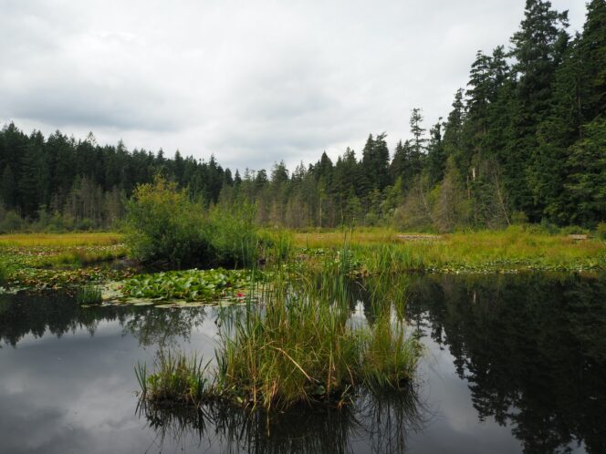
Beaver Lake. Photo: Hendrik Alting/Unsplash
At the south side of the lake, turn left onto the South Creek Trail. Follow it through the forest and into the west side of the Rose Garden. Go straight on the the path to cross Pipeline Road into the east Rose Garden. Turn left and walk north past the Stanley Park Pavilion back to the bus loop and parking lot to complete your loop hike.


