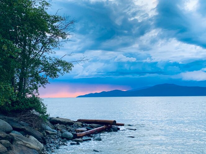
Looking west from Spanish Banks. Photo: Dustan Woodhouse/Unsplash
The easy hike around Point Grey has a bit of everything. You’ll walk on the beach, through the forest, and get to stop for coffee on the UBC Campus.
Trail Info: Easy; 9 km loop, 100 m elevation gain, 3 hours; Dogs allowed, leash-optional
Safety First: AdventureSmart recommends bringing a backpack with essential safety and first aid gear on every hike. Check the forecast and pack extra clothing for the weather. Leave a trip plan so someone knows where you are going and when you will be back. Check out our tips for safe winter hiking in Vancouver for more advice.
Getting There By Car: From downtown Vancouver, go south on the Granville Street Bridge. Take the 4th Avenue exit and follow West 4th Avenue through the Kitsilano neighbourhood. Turn right onto Northwest Marine Drive after passing Jericho Beach Park. Follow NW Marine Drive to the parking lots at Spanish Banks. Park in the furthest lot.
Getting There By Bus: If you take the bus, you will pick up the loop route in the middle. Take bus 4 from downtown Vancouver to the UBC bus loop. From there, walk one block south to University Boulevard. Turn left (east) to follow University Boulevard to the Swordfern Trail. Follow the directions below to complete the loop.
The Trail: This hike makes an interesting loop along the beach and through the forest of Pacific Spirit Park. It also involves a short walk through the bustling UBC Campus, which can be a great place to stop for a coffee and a snack. Use the Pacific Spirit Park trail map to stay on track.
The first 3 kilometres of this loop route follow the beach and there is no formal trail. Instead, you just walk along the coast. Be sure to time your hike for low tide. Use this Vancouver tide table to plan your hike. For the safest (and driest) hike, choose times where the hourly predicted heights are less than 3 metres. If you time the tides wrong and it looks like you’re going to get wet, you can use Trail 3 or Trail 4 (see the map linked above) to get up off the beach into the UBC area.
To start your hike, head west (left when facing the ocean) along the Spanish Banks walking path. The gravel trail ends at a small dog-friendly beach. This is the start of your walk along the coast. You will walk across sand, gravel, and small rocks for the next 3 kilometres.
Follow the rocky beach along the coast. In a few minutes, you will arrive at Acadia Beach. There is a picnic area, parking area, and toilet uphill to your left. Keep walking down the beach for another kilometre. Watch for the first of two WWII-era ruins. Now covered in graffiti, these concrete towers housed powerful searchlights, designed to spot enemy ships.
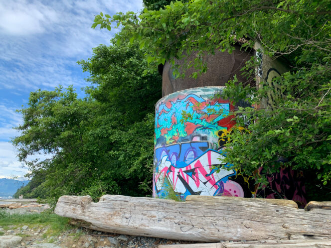
Graffiti-covered WWII era tower. Photo: Taryn Eyton/HappiestOutdoors.ca
Trail 3 heads uphill right next to the first tower. But continue along the beach over the rocks past the second tower. As you walk, the sandy cliffs on your left get higher and higher. As you continue along the coast, the gravel eventually gives way to sand. Pass Trail 4 and keep hiking towards Wreck Beach.
While it is less busy in winter, Wreck Beach is the most popular nude beach in Vancouver. You can expect to see nude sunbathers at any time of year, so be respectful. Keep hiking along Wreck Beach until you reach Trail 6 at the main beach area. This is a great spot for a break.
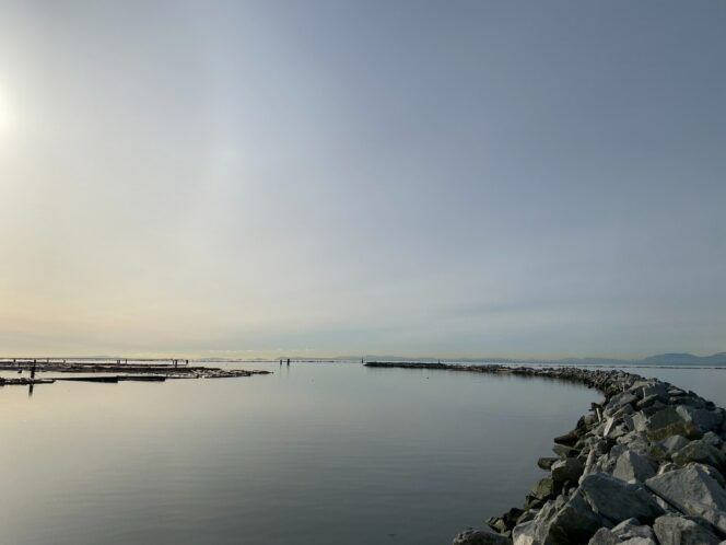
The breakwater at Wreck Beach. Photo: Leo Ching/Unsplash
Now it’s time to tackle the only hill of the hike and it’s a steep one! Make your way up the stairs on Trail 6. There are a few gorgeous old-growth trees to gawk at through this section while you catch your breath.
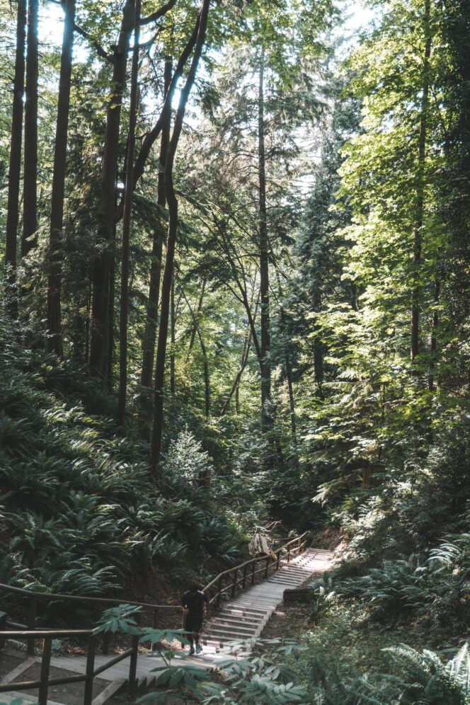
The stairs on Trail 6 leading to Wreck Beach. Photo: Jae Park/Unsplash
Emerge on Northwest Marine Drive and go right for a few metres to the intersection with University Boulevard. Cross the street and follow University Boulevard for the next kilometre through the UBC Campus. If you want to take a break, head into The Nest (the UBC student centre) near the corner of University Boulevard and East Mall to grab a coffee and a cookie from the Blue Chip Cafe. If you are travelling to this hike by bus, you will also pick up the route here.
Once you are ready to continue, keep walking north on University Boulevard out of the campus and into the residential neighbourhood. A few blocks later, turn left onto the Swordfern trail just after passing Acadia Road. If you pass the University Chapel church, you’ve gone too far.
Walk through the forest on the Swordfern Trail for a few minutes, turn turn right at the next intersection onto Spanish Trail. Stay on Spanish as it crosses Salish Trail, then heads downhill into a marshy area. Cross the marsh on a wide wooden bridge, then head back into the forest. There are some beautiful tall cedar and hemlock trees in this section.
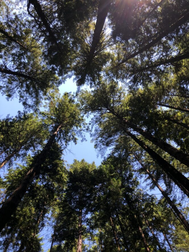
Tall trees in Pacific Spirit Park. Photo: Mia Mackenzie/Unsplash
Ignore the Pioneer Trail and stay on Spanish Trail until it arrives at the edge of Chancellor Boulevard. Carefully cross the street and pick up the Spanish Trail on the other side. Continue hiking gently downhill, ignoring junctions with the Chancellor Trail, Pioneer Trail, and Admiralty Trail. At the bottom of the hill, reach Northwest Marine Drive at Spanish Banks Beach. Follow the oceanside path to the left back to your car to complete the loop.


