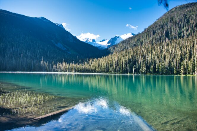
Lower Joffre Lake. Photo: Marco Bicca/Unsplash
Joffre Lakes is one of the most popular hikes near Vancouver and for good reason. The trail travels past three gorgeous turquoise lakes and includes incredible glacier views.
Trail Info: Moderate; 10 km round-trip; 370 metres elevation gain; 4 hours; Dogs not permitted
Safety First: AdventureSmart recommends bringing a backpack with essential safety and first aid gear on every hike. Check the forecast and pack extra clothing for the weather. Leave a trip plan so someone knows where you are going and when you will be back. Check out our tips for safe summer hiking in Vancouver for more advice.
Day-Use Passes: Joffre Lakes Provincial Park is very popular. To manage crowds, you must reserve a free day-use pass to visit the park between May and October. You can book your pass on the BC Parks website starting at 7 am two days before your trip. Each adult requires a pass and you can book up to four passes at once. Passes run out quickly on weekends so consider visiting on a weekday. You also don’t need a pass if you take Park Bus. (See the Getting There section below.)
Getting There: While many people consider Joffre Lakes one of the best hikes near Vancouver, it is actually a three hour drive from the city. From Vancouver, head west on Highway 1, then go north on Highway 99 through Squamish, Whistler, and Pemberton. In the town of Mount Currie, turn right to stay on Highway 99. Follow the road up some switchbacks, then look for the signs for Joffre Lakes Provincial Park. There are two parking areas, one on each side of the highway.
You can also book a seat on Park Bus to go to Joffre Lakes. They offer scheduled bus service from Vancouver several times a month in partnership with BC Parks. If you book with Park Bus, your booking includes your day pass.
The Trail: The trail to Joffre Lakes is easy to follow, with signs at every junction. The park map and Joffre Lakes Provincial Park website provide a good overview of the trail.
The first few minutes of the trail are very easy as you head slightly downhill to the shores of Lower Joffre Lake and the first viewpoint. This is the only easy part of the trail so some hikers turn around here.
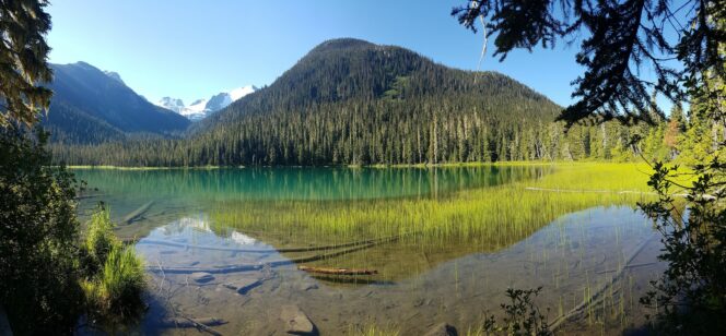
Lower Joffre Lake. Photo: Wim Hovens/Unsplash
From the viewpoint, follow the trail around the lake and across a bridge. The trail through the forest climbs steadily and then emerges in a more open area. After the open area, you will reach the steepest and most difficult part of the trail. There are lots of uneven rock and wooden stairs through here so take your time.
As the slope eases off, you will arrive at Middle Joffre Lake. There is a great rest area here where you can take a break and enjoy the view. There is also an outhouse another minute further along the trail.
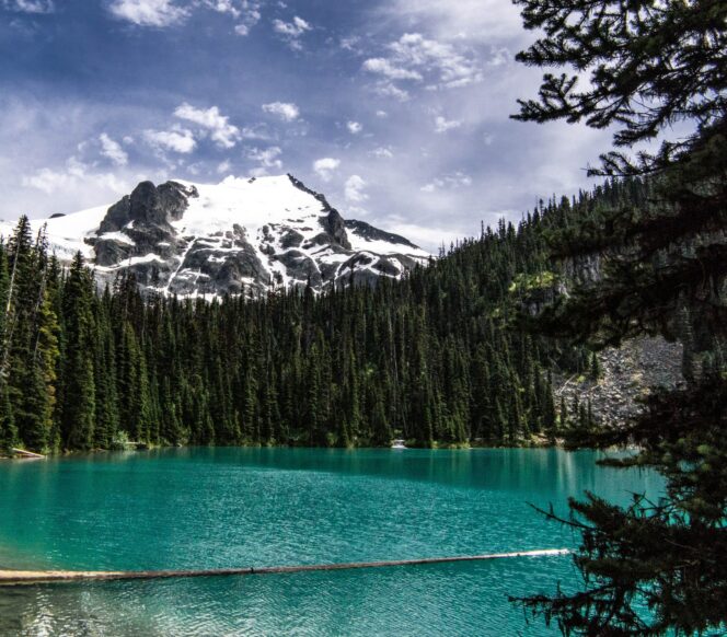
Middle Joffre Lake. Photo: Arnold Dogelis/Unsplash
Just past the outhouse, you will find the Instagram-famous floating log. This is a popular spot for photos. But please be careful as the water is near freezing and hypothermia is a real concern.
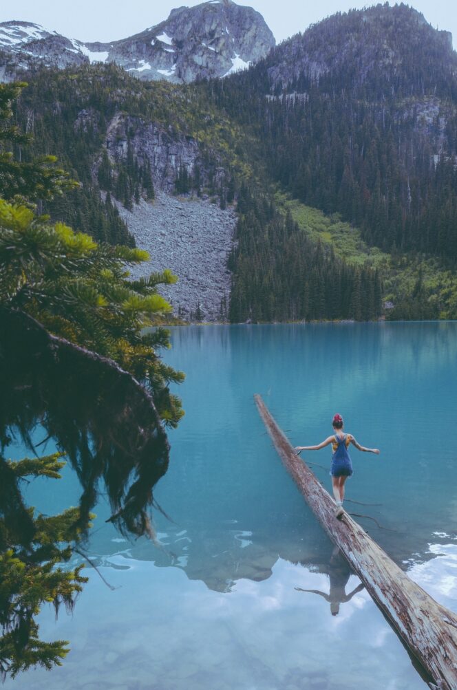
Middle Joffre Lake. Photo: Matt Hanns Schroeter/Unsplash
Past the floating log, the trail heads uphill again to Holloway Falls, another great place for photos.
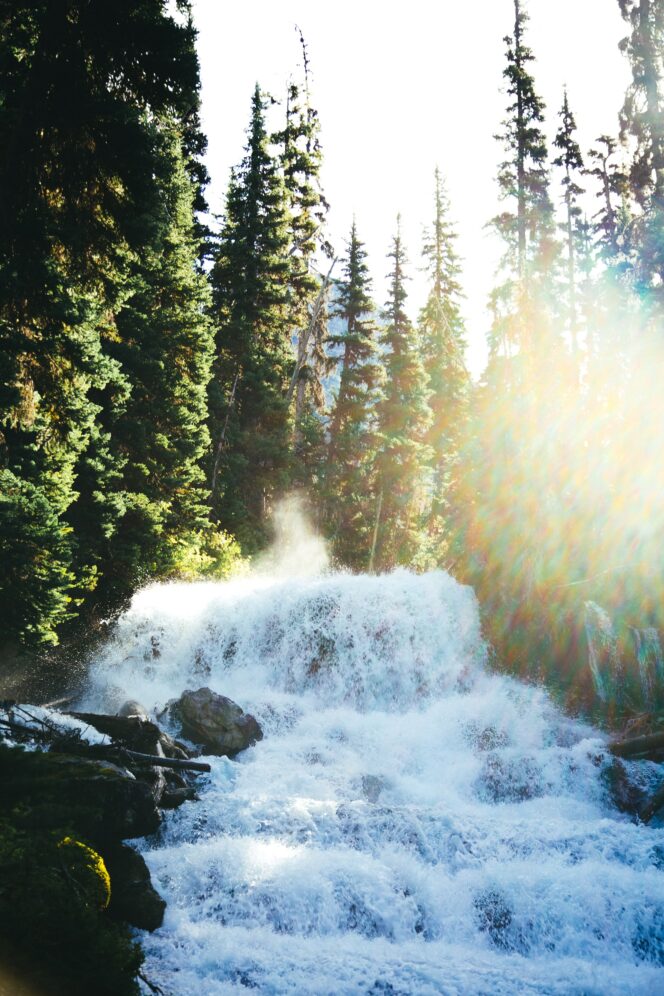
Holloway Falls. Photo: Jack Church/Unsplash
Continue up a few stairs after the falls to reach Upper Joffre Lake. You might be tempted to bee-line for the lakeshore, but stay on the trail as there is a better viewpoint ahead.
Follow a rocky trail to the left to the edge of the lake. There are beautiful views of the Matier and Stonecrop Glaciers high above you. After you have finished enjoying the scenery, you can continue along the rocky trail as it loops back to the main trail. There is another outhouse here if you need it.
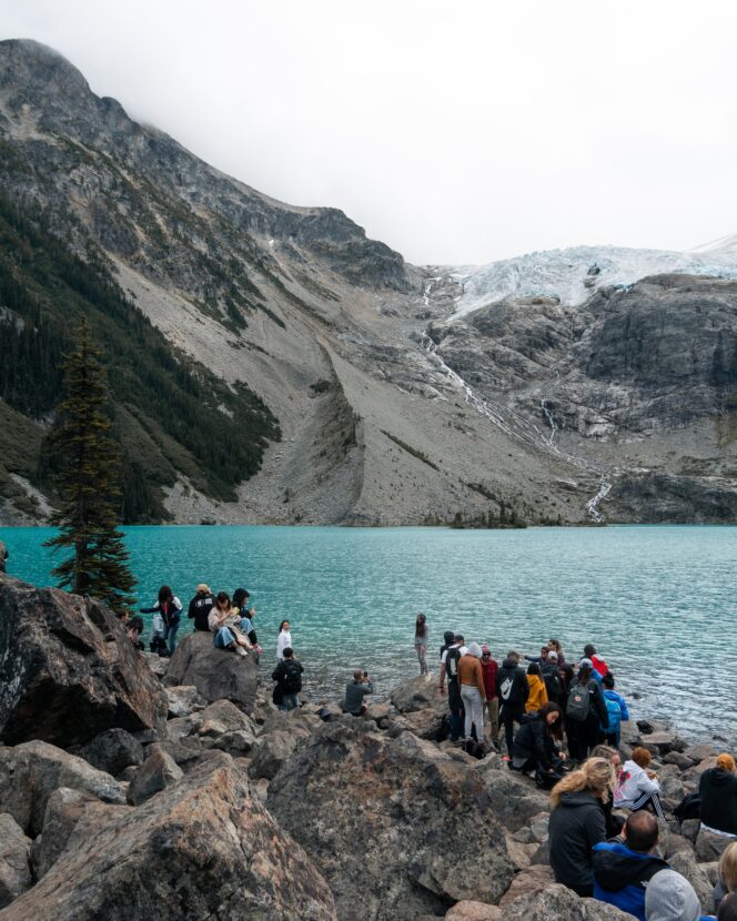
Hikers at Upper Joffre Lake. Photo: Ethan Mabunay
Some hikers choose to turn around here since this is the best viewpoint. However, the trail continues along the edge of the lake to the backcountry campground. The route along the lake is rougher than the rest of the trail with lots of little ups and downs and some rocks and roots to climb over.
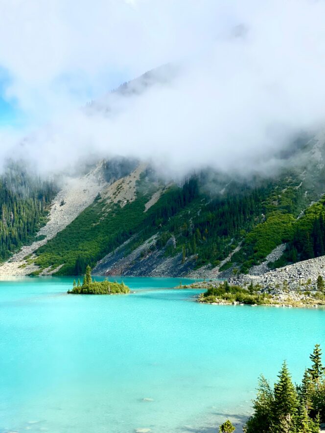
Looking across Upper Joffre Lake from the campground. Photo: Prosha Amiri/Unsplash
From the campground, you can look back down Upper Joffre Lake and across to Cayoosh Mountain on the other side of the valley. There are informal mountaineers’ trails snaking uphill from the campground, but they head into dangerous terrain where deadly rockfall is common, so it is best to make the campground your turn-around point. Retrace your steps back to the parking lot.


